




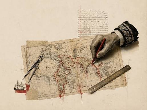
Modern nation-states are demarcated by pencil lines across a map. These lines drawn in a closed room by a few people determine the fates of millions of people. “A pen (a pencil in this case) is mightier than a sword”; this saying has never had more meaning than this. Maps are often drawn by people who aren’t from the region they are demarcating, for example, the Sykes-Picot Line. Many borderlines often overlook essential aspects such as language, geography, religion, and ethnicity. This causes people of the same religion, ethnicity, language, and creed to be split between two different countries just because a diplomat decided that’s where a border should be.
But these diplomats forget that a single line drawn a hundred years ago won’t be enough to stop the exchange of people, relations, ideas, and trade through those areas, which have been doing so for thousands of years. The Durand Line, which is the border between Pakistan and Afghanistan, is such an example. Just because the map line separates the two regions doesn’t undermine the fact that the two regions of Afghanistan and Pakistan (the KP Pashtun regions) have had relations and trade with each other for over a millennium. That’s one of the reasons Pakistan can’t completely wipe out TTP.
The border between Pakistan and India is also one such example. The Englishmen ignored communal aspects while drawing the border. This led to one of the biggest migrations in human history when Punjab was divided into two. Not just that, the number of atrocities, massacres, and bloodshed committed during these migrations has only a few equals in history. Tens of millions of people were affected.
Compare this to the borders of European countries; you will see those borders are less arbitrary and more peaceful. Much of the reason is that many of those borders weren’t drawn on a map by diplomats; they follow the natural courses of mountain ranges, rivers, and other geographical features, giving those countries natural borders rather than arbitrary ones. As a result, people of the same religion, ethnicity, or language are less likely to be separated.
The borders of nation-states in general are a very funny idea. In a war between two countries, the civilians of the two countries—just because they were born a few kilometres away from the borderline—are now enemies; if they had been born a few kilometres under the line, they would’ve been friends.
Take the example of the Arabian Peninsula. People from one region often had relatives they used to visit far away from that region. With the division of that region into different countries, the Arabs found it strange that, if they were to visit relatives living far away, they now needed a document (a visa) for that journey, issued by a third party. Here we see how alien the concept of these arbitrary borders is.
The sad part is that these arbitrary borders are usually in countries that were former colonies, making this a colonial legacy. The colonisers, who weren’t even from that region, deciding the fate
of those colonised on their behalf is one of the most vicious atrocities colonisation has inflicted upon its territories. This has caused major problems. The division between Pakistan and India, the way it was carried out, is a ticking time bomb, as it is one of the possible major causes of a nuclear war. The division in the Middle East still wreaks havoc due to conflicts in each country, be it Syria, Iraq, Iran, Palestine, and Israel. African countries were hit the hardest by this, as arbitrary borders left the region destitute and unable to develop.
Most conflicts in today’s world are the direct result of these map lines that cut through feelings, relationships, and geographical features, leaving nothing but chaos and destruction in their wake for decades to come, with no end in sight.