


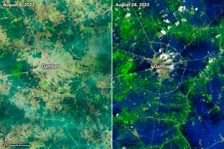
Satellites: As the backward system of relief against floods, turns out to not be sufficient, the Pakistani government looks for innovative solutions.
Pakistan’s national space agency SUPARCO is using satellite mapping and real-time imagery to aid rescue and relief operations from afar—providing a holistic approach, officials said on Friday, as monsoon floods have destroyed much of the country, killing over 800 people since the beginning of the season and destroying farms and livestock.
The agency established its Space Application Center for Response in Emergency and Disasters (SACRED) in 2014 to provide space-based support for natural disasters, from floods and droughts to glacial lake outburst floods (GLOFs), earthquakes and landslides. With extreme weather striking more frequently, SACRED is now central to disaster management planning across the country.